Clearance of the Central Area in Beeston, Notts - about 1963
|
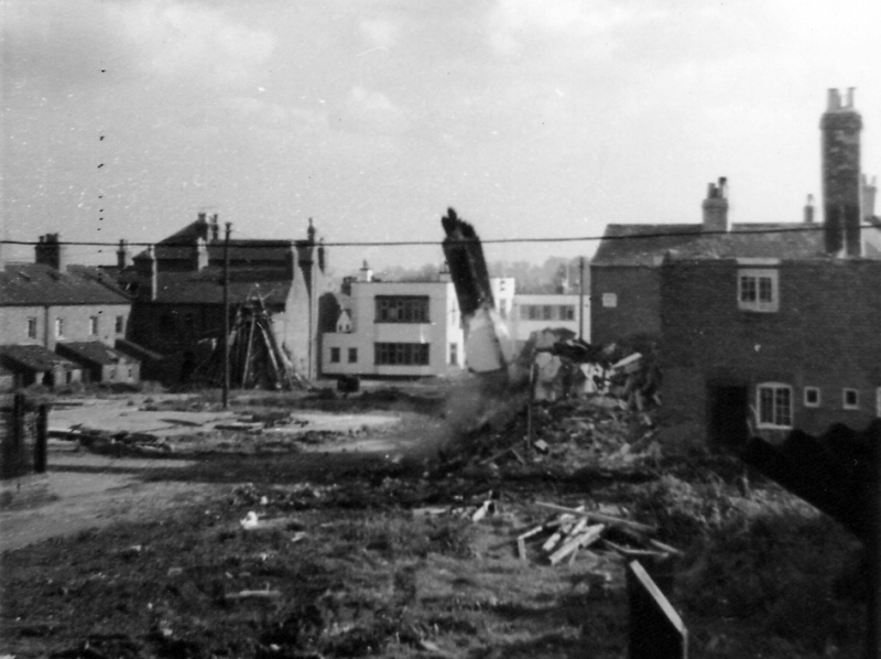
Looking south, from the area of Styring Street, with demolition and site clerance well under way.
The white building in the middle is the White Lion pub.
On the left are the backs of terraced houses which faced Station Road, near its junction with Middle Street.
|
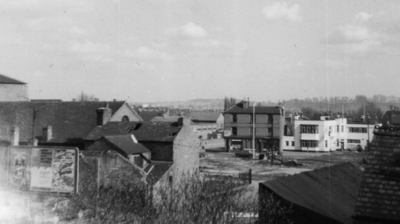
Another, slightly more distant view, again looking south. Chapel Street has now been almost totally destroyed.
Just visible, above the group of buildings on the left, is the apex of the roof of the New Connexion Chapel on what was still left of Chapel Street
The taller building, slightly in front of the White Lion, was on the south-west corner of Middle Street and Station Road.
One of the shops in this block was run by Mrs Bailey, where maggots for fishing could be bought
|
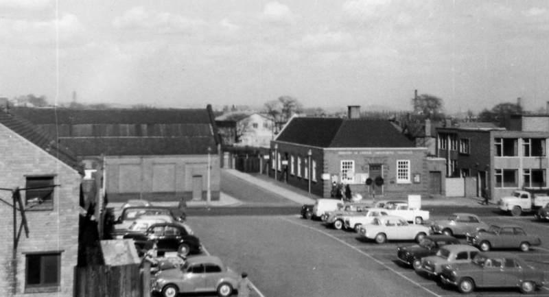
A slightly later view, possibly in 1964, with the middle section of the site opened as a carpark
Across Station Road can be seen Marvin Road, with the Lads' Club on the left and Employment Exchange and Benefit offices on the right
In the far distance can be seen the then newly opened Conservative Club on Acacia Walk, built in 1963 after it moved from the High Road
Marven Road and the area either side was developed as the site of Tesco in 2010.
The carpark was later developed as the bus station with an adjacent multi-storey carpark.
A Fire Station was opened to the south of this section in March 1965. It was vacated in 2010.
From a series of photographs taken by the late Bob Alvey
As a boy, Bob lived on Styring Street, part of the area involved in the redevelopment.
Close this window to continue
|
 |